
The Sea of Sand and The Sea of Stars
The year is 1428, and you wake at dawn. You scan across the group of camels perched a ways away from the camp. It had been a few days since the caravan had left, and you hadn’t encountered any sandstorms. The wind howls in the distance, picking up some sand across a dune.
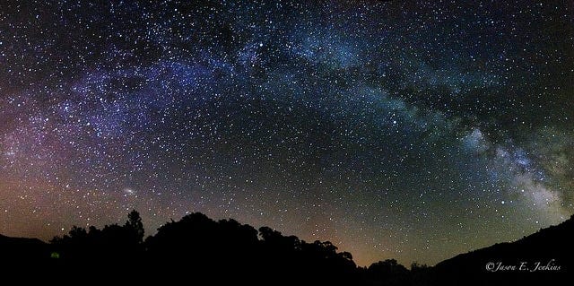
Around you, the shifting desert dunes offer no landmarks—only a featureless, treacherous sea of sand that looks entirely different than it did when you pitched camp. Picking up your directional stick, you step away from the camp's edge and tilt your head back, holding your breath. Your heart steadies. The sweeping dust of the previous twilight has cleared, leaving behind a flawless, velvety canopy dusted with a million piercing diamonds.
You exhale slowly, and your breath condenses in the freezing air.
"شکرِ خدا، آسمان پاک است."
“Thank the heavens, the sky is clear”, you whisper into the dark.
Because a clear sky means clear sight, and sight means survival. If you miscalculate your bearings today, the entire caravan will run out of water days before reaching the next oasis.
You pull out your kamal, a deceptively simple tool; just a small rectangle of dark, polished wood with a knotted string threaded through its centre. You place a knot between your teeth, pulling the cord perfectly taut until the wooden card floats before your eyes. Squinting through the dim twilight, you align the top edge of the card to touch the faint, silver pierce of Polaris, while the bottom edge perfectly skims the pitch-black line of the desert horizon.
You slide your fingers along the string to count the knots. Three knots out. The angle of the star doesn't lie; you know exactly what latitude you are on, and you know the course to take.
Lowering the card, you turn to your crew, huddled around the dying embers of the campfire, anxiously watching your silhouette against the sky. You drop the string from your mouth, raise your hand, and command the camp.
“بار بندید! وقتِ کوچ است.”
“Bind the loads! It is time to march”
The camels grunt, and canvas rustles as the ancient machine of commerce stirs back to life, guided across a featureless desert by a string, a block of wood, and a star.
A New Constellation
The year is 2026, five centuries later, and you are late for work. You were supposed to have checked in 18 minutes ago, but you’re still opening your smartphone to order a ride. In the next few seconds, a complex set of operations occurs, allowing your phone to know exactly where you are on the surface of the earth.
A blue dot appears on a map.
GPS standing for Global Positioning System, is the common term we use for navigation on our digital devices these days. In actuality, it refers only to the American constellation for global navigation. The more generic term for this technology is GNSS, which stands for Global Navigation Satellite System.
A Global Navigation Satellite System is a space-based network of satellites orbiting the Earth, continuously transmitting radio signals providing positioning, navigation, and precise timing data to receivers anywhere on the globe. Any device with a compatible chip—such as your smartphone, a smartwatch, or a car's dashboard navigation—acts as a receiver that reads these space signals to map your exact coordinates. Four major operational global constellations fall under the umbrella of GNSS:
GPS (Global Positioning System): Developed and maintained by the United States.
Galileo: Developed and operated by the European Union.
GLONASS: Developed and maintained by Russia.
BeiDou: Developed and completed by China.
The Math
At its core, satellite navigation relies on a surprisingly simple mathematical formula; one that we have been taught from primary school (or elementary school).
We can calculate the distance between our receiver (us) and the satellite by measuring how long the radio waves (moving at the speed of light) take to reach us from the satellite.
Satellites carry incredibly precise and expensive onboard atomic clocks. When a satellite broadcasts the radio signal, it embeds the timestamp indicating exactly when the message left the spacecraft. When your receiver grabs the signal, it notes the exact arrival time. By calculating the difference between the departure time and the arrival time, the system determines the signal's transit time.
The Geometry
To actually get your location on the surface of the earth, we use that simple equation in conjunction with the constellation of satellites orbiting the earth. By measuring the distance from us to three different satellites, we can use trilateration to determine where on the surface we are.
Three satellites are enough in theory, but in practice, a fourth satellite is needed. This is because your smartphone or car navigator does not have an atomic clock in it; it uses a cheap quartz clock. If your phone's clock is off by even a millionth of a second, the distance calculations will err by hundreds of meters because the signals travel at the speed of light.
This all sounds pretty straightforward, but there’s a detail that we missed. For us to use trilateration to get our position on Earth, we need to know exactly where each satellite is. The complication here arises from the fact that these satellites aren’t stagnant; they orbit the earth at mindboggling speeds, so how can we know where they are with millimetre precision?
The Ground Watchers
Enter the Earth-based stations. They determine and maintain the precise position of navigation satellites through a highly coordinated loop of tracking and mathematical modelling. We can boil it down to 3 major steps:
A globally distributed network of ground monitor stations continuously listens to and tracks the radio signals broadcast by the satellites flying overhead. They track the satellites to check their exact altitude, position, and speed.
All the tracking data collected by the global monitor stations is sent to a centralised facility known as the Master Control Station. It takes these raw tracking measurements and does some fancy maths to calculate the satellite's exact orbital path and atomic clock performance.
Once the Master Control Station computes the corrected trajectories and clock drift corrections, this fresh data must be sent back up to space.
For ground stations to accurately determine a satellite's position in space, the ground stations themselves must know their own position on Earth down to the millimeter level. To achieve this, the earth-based network uses deep space radio waves to anchor itself to a precise location on the earth.
Anchoring to the Edge of Time
If the ground stations are correcting the satellites, what is correcting the ground stations? The Earth is not a stable platform; its tectonic plates are constantly drifting, its axis constantly wobbling. We live on an ever-changing sphere of matter.
To fix the coordinates of the base stations, we must look beyond our planet, past our solar system, and out to the very edge of the observable universe using Very Long Baseline Interferometry (VLBI).
VLBI is a technique originally developed in the 1960s to capture higher-resolution images of deep-space radio sources. Scientists later discovered that if you throw the calculations in reverse, the process can be used to map and measure the Earth with extreme accuracy.
By using a globally distributed network of multiple radio telescope antennas on Earth that simultaneously focus on the same cosmic quasar—an intensely bright, energetic core of ancient, distant galaxies positioned at the edge of the universe—they can use the differences in when each telescope reads the waves from quasars to calculate the physical distance between the telescopes down to the millimetre level.
Stars show the Way
All these systems together create a complete loop of cosmic orientation that powers our daily technology:
Your smartphone calculates its position by communicating with satellites and getting the difference in timing;
The satellites track their orbits using Earth-based ground control segment stations
The ground stations are locked firmly in place because VLBI aligns them with the absolute stability of quasars at the edge of time.
Humanity's reliance on the cosmos has never truly changed—only our instruments have. The Silk Road trader looking up at the steady light of Polaris to guide his camels through a dark desert, and a modern driver navigating a bustling metropolis by watching a blue dot on a smartphone screen, are fundamentally performing the exact same act.
They are both outsourcing their sense of place to the absolute stability of the deep cosmos. We never stopped navigating by the stars; we just found older, brighter, and deeper lights to guide us.
They say history doesn’t repeat itself but it often rhymes and I cannot help myself but find the beauty and intricacy of today’s GPS systems deeply poetic.
I was deeply inspired by this video: https://youtu.be/tz23G_UXCGA?si=IkB7YopnGbyVE4A2
And will also recommend watching it. 🙏🏾
The story telling is really good 🎉 The use of the story to get to the point is really genius. 🙌🏾